Middle Creek Wildlife Management Area
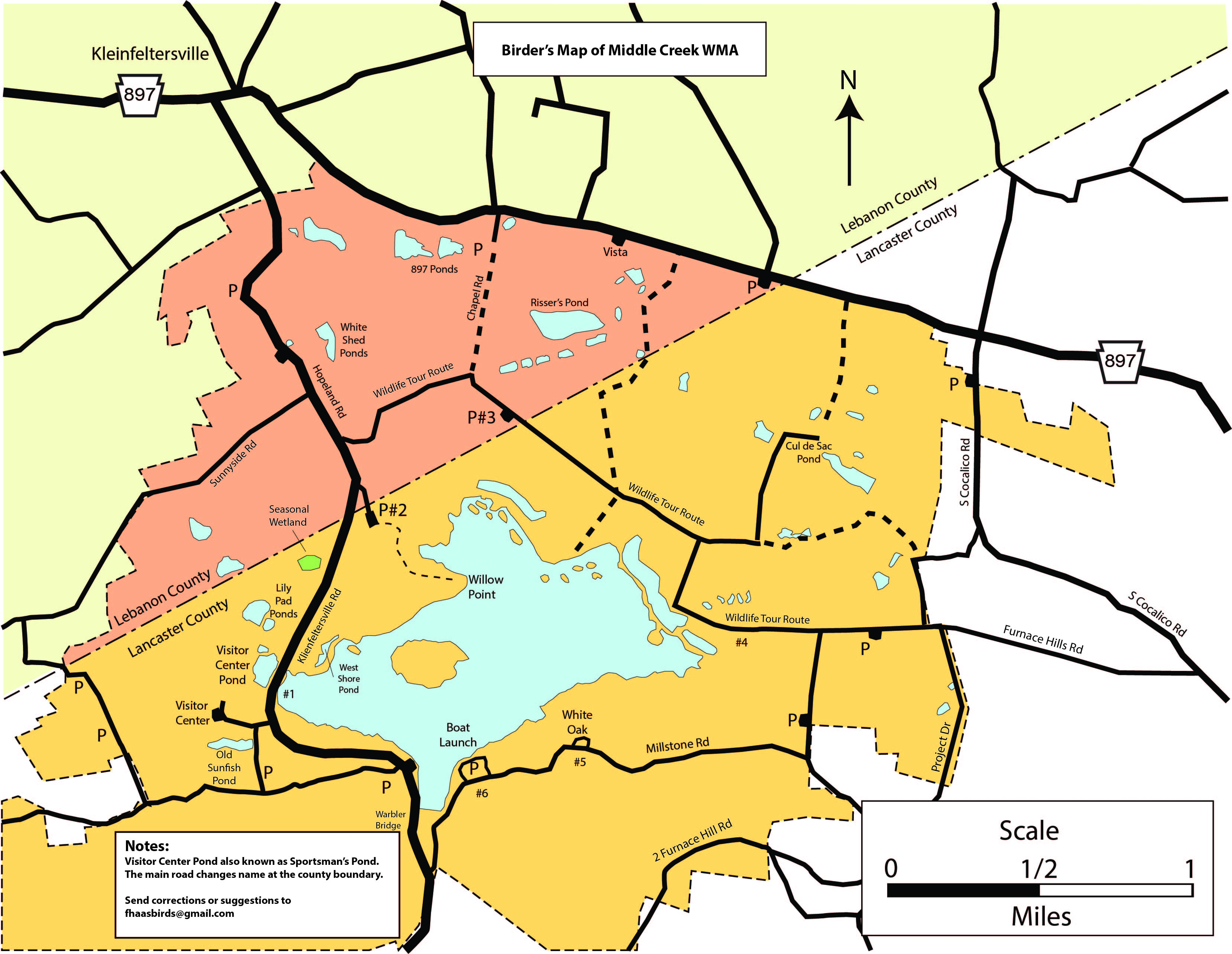
This is a simplified map for use by birders to refer to frequently-mentioned birding locations.
I created names for various ponds, etc. since they had no names on the official MCWMA map.
I am open to suggestions for other names or other locations to name.
Contact me at fhaasbirds@gmail.com
To print it, click on it to download it as a PDF document and then print it.
It should REALLY be printed in color!